Wednesday, June 1, 2011

Yosemite and the Axle Seal

What is it about a place that makes it magical? This isn't the first time I've seen towering mountains of granite. I've seen cascading waterfalls. I've seen rushing streams. I've seen lush green meadows. So how is it that these things, despite the throngs of people, rushing cars and rumbling shuttle buses, are somehow more awesome and inspiring at Yosemite National Park than anywhere else?

Driving into the park from the south we had over an hour of winding mountain roads through which to coax Gigantor's ample hips. A tunnel looms ahead, Garmin chimes out its "low clearance" warning, the light at the end grows larger and reveals...Yosemite Valley. It's all I can do to keep my eyes on the road and steer into a parking space. I've heard of these sights, even seen them in Ken Burns' documentary, but wow...El Capitan...Bridal Veil Falls...the Half-Dome...they take my breath away...

1st view:
Unfortunately the view wasn't the only thing we saw when we alighted from the truck at the overlook: we also saw smoke wafting from the right rear wheelwell. A look underneath at her unmentionables revealed an oily mess radiating out from the axle over the surface of the inside tire. What to do? We're in Yosemite Valley, over an hour from camp - we decide to ignore it for now...deal with later...hope to make it back to camp without a catastrophic failure...

...tearing ourselves away from the overlook, we rolled downhill into the valley for a closer look. first stop: Bridal Veil Falls. I grabbed our raincoats on a whim, and we joined the masses on the trail up to the base of the falls. The stream fed by the falls was raging, tumbling and roaring over its banks, luminous in the sunlight filtered through the trees. As we proceeded the trail became wet, then it was covered by a film of flowing water, getting deeper...we put on our raincoats. As we approached the falls air and water merged into one. The deafening tumultuous cascade of water pounding onto the rocks generated a massive cloud of spray, blown by the winds in waves of rain.


We were instantly soaked. In between surges of water I yanked the camera from my raincoat pocket, captured a photos, and jammed it back in. It was amazing, and cold, and we could hardly breathe! We retreated to watch from a distance. Then moved on up the valley, stopping to admire...

...El Capitan. Such a looming, formidable edifice of stone. Upon closer examination, through binoculars, I was able to spot several groups of rock climbers, looking ridiculously small and insignificant clinging to the sheer surface. I've rock climbed, but holy chalk bag Batman, that's one tough nut. I wonder how long it takes to climb bottom to top.


We parked for the day, planning to ride our bikes all around the valley. But, what's this? My burly mountain bike tires are nearly flat! And my pump is back at camp! Crap! Discouraged, I put the bikes back in the truck and we caught a shuttle to the Visitor's Center. But on the way there I saw the park garage, and there right up front was an air station! Back for the bikes! But wait...foiled again! My bike has presta valves and the air station only inflates shraeders. I won't take "No" for an answer: there's also a "shop air" type nozzle, usually used to blow off debris from a work piece. Somehow I managed to fit it over the valve and inflate my tires. Yay! So we ultimately were able to tour Yosemite Valley by bike, quietly and leisurely enjoying all of the breathtaking scenery that makes this place so special.

Yosemite Falls:

Mirror Lake:
The Half Dome:

Yosemite is truly an amazing place.

Back at camp I had to face the reality of an unscheduled truck repair. First thing in the morning I started calling around and eventually found a shop that could take the truck right away. I threw the bike in back and drove the 9 miles over to nearby Oakhurst. The bike ride back to our camp in Coarsegold started out OK, riding the first 3 miles uphill on little back roads that the mechanics told me about. But the rest of the way, albeit downhill, was on route 41, which is a narrow, winding two lane, heavily trafficked, and sorely lacking, in many places, any hint of a shoulder. So, the cars had very little room to give me space. I kept my tire on the white line which put my handlebars over a foot into traffic. It was hairy as hell, and when a big utility truck passed so close that it's bow wave shoved me to the right, then the suction from it's passing pulled me back to the left, it was truly terrifying. My dislike for road riding has been renewed to an acute level - give me a serpentine single-track trail through the woods. I begged a ride from the campground hosts the next morning to retrieve the truck from the shop. (Thanks Walter and Nancy!)

We found a really nice trail along a roaring stream tumbling through a series of waterfalls. It was on National Forest land, so Toby could come along, and was able to be off-leash most of the time, which he loves:


On the way back we stopped for groceries and as well pulled in to park I heard a new noise. The mechanic's shop was right around the corner, so we went right over and one of the owners, Mike, hopped in the truck bed and listened as I cruised around a quiet back street. He heard what I heard and immediately set about figuring out what it was (a bent brake shield) and putting it right. Grateful, we got our shopping done and headed back to camp. But Oh! No! Will it never end? Stepping out at camp we are dismayed to detect the same smell that we encountered at Yosemite, and the same smoke wafting up from the right rear wheel! Ugh. Back to the shop 1st thing in the morning. Again they immediately set to work on it, uncomplaining. The wheel, brake and axle assembly had to be completely dis-assembled once again in order to insure that there was no new leak. They confirmed that it was indeed just residue from the initial leak still burning off. It was a lot of additional work, but we all felt better knowing that the repair is good, and I drove off satisfied. Thanks to Mike and Doug at Elite Auto Service in Oakhurst, California for a job well done, and for their patience and time in the aftermath. Also, if you happen to have a Toyota 4Runner that you want to trick out for serious off-roading, check out Doug's website Savage Off-Road.

Monday, May 30, 2011

Oranges and Giants

Two successive drives from Lake Mead reminded us why we don't like to drive two days in a row: we get really tired of being in the truck. Drove 1st to a dusty little desert town called Boron, home of the California's largest open pit mine - the Borax mine. Whoo-hoo! It was a dingy little RV park, mostly occupied by broken down relic trailers, scattered with derelict cars replete with duct tape & bailing wire, and owners staggering about, blinking in the sunlight, cigarettes a-dangling. The wind blew with unrelenting ferocity - it required two of us to get a dog through our door, one to hold the door, one to help the dog. We were glad to leave, but not glad to drive again. But after crossing some mountains we suddenly entered grove country, and the wind quieted down. Miles and miles of fruit trees, some already harvested, some laden with fruit.


When we stopped for lunch I investigated a couple of trees in an already harvested grove, and I found a few that got left behind. I picked 6 huge, perfect naval oranges, the best we've tasted. Moving on, we arrived at our campground in Lemon Cove, California. This campground, too, has seen better days, and has its share of antique trailers with blue tarps stretched over their roofs to keep the rain out. But, there's flowering shrubs and trees, including olive trees. I picked a quart of the vile fruit to cure for Nancy and the boys who, for some reason incomprehensible to me, actually like to eat those little black balls of evil.


As the Memorial-Day-weekend crowd poured in the park took on a friendlier feel. There were several huge hispanic families camped there, cooking and playing games, making it feel festive, filling the air with the happy sounds of Spanglish.

We headed uphill along the raging Kaweah River to Sequoia National Park.


This is the first time we've visited one of our National Parks on a holiday weekend - we've been spoiled. It wasn't so nice. Trying to find a parking space for Gigantor at the visitor's center or at a trail-head was challenging, then bumping shoulders with flocks of people, so many of whom were rude. American's are known for being obnoxious tourists, and some certainly are, but some of our foreign friends could stand a lesson on common courtesy as well. In order to see the really big sequoia trees we had to endure the crowds. Luckily, the world's biggest tree, General Sherman, is so big that we found a spot around its base less crowded, and got a chance to appreciate the majesty and beauty of this specimen.


How big is it??? This is the largest single-stemmed tree on earth (as measured by volume) measuring over 36 feet in diameter at its base, over 100 feet in circumference at its base, and over 275 feet tall. If you laid Nancy and I end-to-end, it would take 3 sets of us to equal it's diameter. It would take 44 Tobys to reach around the base. A whopping 137 Kinseys would be required to reach the top. That's a lot of westies!


Up in the forests, above 6500' of elevation, we were in the clouds. The trees were enshrouded, and driving the twisty mountain roads through the park was a challenge, with severely limited visibility:


So, we didn't see much else until we descended out of adjacent Kings Canyon NP and drove back to camp. This drive to camp started out so much fun - switchbacks and tight turns following the wrinkles of the land. It felt like I was turning the wheel lock-to-lock over and over and over again, trying to keep our speed comfortable in the turns but also get home as soon as possible. After 15 or 20 minutes I was pretty tired of driving, but it went on and on and on. It took over an hour before we were finally back on the valley floor. It was gorgeous, don't get me wrong, but a 22' long one-ton dually pickup truck is not the right vehicle for extracting enjoyment from such a road. Turn me loose on those bends in a low-slung BMW Z4 and I'd be grinning!

We've been suffering a constant battle with grass seeds which were embedding themselves in the dogs' feet.
We've actually been dealing with this since Zion, and most nights I spend time with a strong light and tweezers, picking seeds out of dog feet. These seeds are pointed and barbed, designed by nature to embed themselves in earth or in flesh. I've pulled some out of Toby that were sticking more than 1/8" deep in the flesh between his pads, creating an irritating bloody wound. I can't wait to move out of the habitat of these nasty grasses.

We loved, however, the perfect temperatures here in the foothills of the Sierra Nevada mountains, and the abundance of fresh fruit. We filled up on the best oranges and strawberries we've ever tasted.

Tuesday, May 24, 2011

Lake Mead

Our route from Zion took us into the Las Vegas area (from heaven to hell?). This city wasn't on my hit list, but it was the right number of hours from Zion, and nearby Boulder City attracted my interest being on the shores of Lake Mead and having a well-reviewed mountain bike trail system.

We camped at the full-hookup RV park within the Lake Mead National Recreational Area. Every day we were there it got up to 95 degrees, so even though there is a beautiful no-hookups campground with big, private sites and gorgeous flowering shrubs 100 yards away, we weren't going to go without electricity to run our air conditioner. Plus, we just left Zion with no hookups, and it's a chore to keep batteries charged even in moderate temperatures. ANYWAY...it was hot. Hot. Hot. Hot. Too hot to be outside mid-day. It was "hotter than a Times Square Rolex"..."Hotter than two rats f-ing in a wool sock" What?!? Damn, that's hot weather...

Nice view from camp:


So, in order to be able to ride when it was cool I had to get up at dawn. Well, shortly after dawn. By 6:00AM the sun is already clear of the mountains on the far shore of the lake. I made it up to the Bootleg Canyon trailhead by 7:00 and found it comfortable enough. I headed for the summit, excited to ride down some of the downhill trails I'd read about. Up top I paused to admire the zip line setup that originates there - looks like an amazing ride in-and-of-itself. I found the downhill trail, strapped on my elbow, knee and shin guards, lowered my seat, and took the plunge...

Now, this isn't my first time riding downhill trails, and I've seen what I consider to be knarly hard core single track, stuff I won't ride, but this...this was freakin' ridiculous. Sure, it was OK for just long enough that I didn't want to hike back up, so I kept going down, thinking, hoping that it would get better. Nope...1st it got worse. Mostly I descended on foot, and that was super scarey and challenging while carrying my bike. This trail was totally gonzo, just plain stoopid. I can't imagine that it is rideable at all. Look...I'm not kidding...this is the trail!:


Well, when I made it down to the foothills it mellowed out and got actually pretty good. I looked back up at the insanity I'd just hiked down, then hopped back on the bike to try to salvage the ride. So, zipping around up and down the undulating foothill terrain, I'd occasionally catch a little air over a sharp transition. It's something I like to do - adds a little excitement when the going gets smooth. I come flying over one such berm, both wheels enjoying a zero gravity moment, and I see, directly in my landing zone...a snake. Well, seeing as how steering and brakes don't do much good when you're not technically in contact with the earth's surface, I did the only thing I could do...I landed on the snake. To be more specific, the rattlesnake...


I heard it rattle in surprise and anger as I rolled/skidded to a stop. I grabbed the camera and hurried back as it slithered for cover, forked tongue flicking in and out, tail buzzing its warning. I got snapped a few shots before it found its hidey hole and coiled up inside to sulk. I've been wanting to see one of these ever since we've travelled in desert regions, and it was really cool to finally see one up close. Sucks that I had to add my tire marks to it's diamond back, though. Hope it's not injured.

In the afternoons we sought relief from the heat, taking the dogs down to a boat ramp where they could swim and we could dip our feet in the cool lake water. Kinsey likes wading in the water and then rubbing in the sand, but Toby really had a ball:


Late afternoon sun and clouds highlight some of the islands in Lake Mead:


Had to take a ride into Las Vegas one evening, to see what that all looks like. Here's a shot of the Fountains of Bellagio dancing to music, while Bally's and the Eiffel Tower glow on The Strip in the background:


I'd tell you all about our night on the town, but you know the rule..."What happens in Vegas, stays in Vegas." OK, prison library's closing now. Gotta go!

Sunday, May 22, 2011

Zion National Park

3 feet cost us an hour...

Bumper to bumper Gigantor and the Whale measures 53 feet long. (They're 8 feet wide and 12 1/2 feet tall in case you were wondering.) In order to pass through the tunnel in the Zion-Mount Carmel Highway (the shortest route to Zion National Park from Kanab, where we were staying) we had to be no more than 50 feet long. So...we had to drive an extra hour all of the way around to enter the park from the west side. Oh well. It gave us a chance to drive through the polygamist stronghold of Colorado City, which I've been reading about in Jon Krakauer's excellent but disturbing book "Under the Banner of Heaven". A small, not very affluent "city" with enormous, but modest, homes, presumably to house equally enormous families.

We had packed up the night before and then left Kanab early (for us), at 7AM, aiming to arrive at Zion by 9:00. With no reservations to the booked-solid Watchman Campground, we had to vie for a site at the 1st-come-1st-served South Campground. We don't love the process, feeling a bit like vultures as we circle the sites, scoping out who looks like they're leaving, and looking at everyone's site tag to see what date they depart. Also, the park roads were narrow, curvy, and tree lined, so navigating the bulk of the whale through there was not at all pleasant. Anyway, we snagged a very good site and got settled in by 10:00, which is just about the time we usually are leaving any given camp.

It was a cold and rainy day, so, despite having all kinds of time on our arrival day, we didn't get much out of it. Also, this is a no-hookups campground, so use of electronics was very much limited. But the next day dawned bright and clear, and I struck out early to do the exciting Angel's Landing trail.

The pointy tip of the massive red bit of rock is Angel's Landing:


The trail starts out innocently enough, winding along the Virgin River, wide and level. And then, the switchbacks commence:


Up and up it goes until, at the saddle of the mountain, the trails follows a knife-edge ridge up and out to Angel's Landing. Chains are fastened to the rock to provide handholds in particularly dangerous areas.


It's steep, physically demanding, and not for the faint-of-heart. I loved it! The reward is 360 degree views of the canyon, and 1400 feet straight down to the canyon floor. Peregrine Falcons and California Condors soar hundreds of feet below. It's a great place to be!


Jutting out from Angel's Landing is a buttress of stone, circled by the Virgin River, the park road, and finally the sandstone mountains:


Got Vertigo?


The hike back down was quick but punishing to the legs. For the next two days my quads were very sore. One of my favorite hikes of all time.

Nancy and I rode the shuttle out to the end of the road (no cars allowed during summer months), then hiked to the Narrows, where the Virgin River occupies all of the gap between the towering canyon walls. When the river is somewhat more subdued it is used as a hiking trail. The Narrows trail, in summer, is a wading adventure deep into the canyon, which sounds like fun. Next time!


The next day, Saturday, the park got quite crowded. We joined the throngs to walk the Emerald Pools trail, where year round springs spit water out of the canyon walls feeding a stacked series of pools. Here is the view of one of the waterfalls:


We found a less-travelled path back, cut into the slope 150 feet above the river. Here we found lots of flowering shrubs and cacti, and this scaly fellow:


We finished up our stay by riding our bicycles into the town of Springdale, just outside of the park gates. We had a nice meal at the Bit and Spur, sipping fresh sangria and munching on chips, guacamole, fish tacos and enchiladas. Good stuff!

Wednesday, May 18, 2011

Best Friends Animal Sanctuary

After leaving the North Rim we popped down the road to Kanab so that we could pay a visit to the Best Friends Animal Society, the largest no-kill sanctuary in the world. Their 3000 acres in Angel Canyon are home to around 1500 dogs, cats, horses, pigs, rabbits and birds.


Our visit included a tour of the facility and some volunteering. Because we were last minute additions "Dogtown" already had all of the volunteers they needed, but we were able to help out with the cats, providing me with my first ever opportunity to walk a cat...


...and a chance to meet cool characters like this guy:


This shelter, funded entirely by donations, takes in animals from all over, where-ever unwanted or abused pets are to be found. They fix them up, train them, spay/neuter, and then place an extraordinary percentage them in permanent homes. They also work hard to promote adoption of pets as a more responsible alternative to breeders and, most of all, pet shops. Kinsey and Toby are from breeders. We certainly don't regret getting them, but we've gotten the message, and when we are ready for another pet, we will certainly look at adoption first. Best Friends is a great organization and an amazing facility. If you ever pass through southern Utah, stop by and give them some of your time.

Monday, May 16, 2011

The G.C.

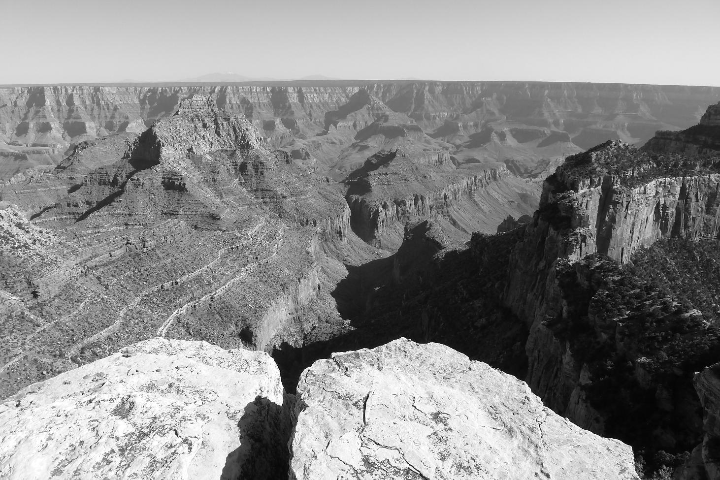
The Grand Canyon: that incomparable 277 mile long, 18 mile long, 6000 foot deep, 2 billion year old rift in the earth's surface. It's impossible to take it all in from the rim, even the 8800' elevation of the north rim where we stood. Words can't do it justice, and neither do my photographs. Not that I won't try!

The 40 mile drive through the conifer forest gives no sense of anticipation that an end-of-the-world-like dropoff lurks ahead. The trees suddenly open up to reveal the absence of terra-firma - a surge of adrenaline heightens the senses; the pulse quickens. No matter that we know that it's there, and know more-or-less what it looks like, it still provokes a feeling of discovery.

It's so deep and wide that our brains can't estimate the distances. The far wall is so many miles away that the haze in the air blurs all features but the high contrast of red and white layers of rock. All we can do is stare and try to imagine the great forces of nature and time which created such an awesome spectacle.

Insomuch as photographs fail to capture what our eyes perceive, I have chosen for display several which also include our own persons, in the hopes that if one object of beauty fails to impress, perhaps the other will suffice:


Saturday, May 14, 2011

In and Around Bryce Canyon

From Capitol Reef we headed south on Scenic Byway Route 12, climbing way up over 9500' where we stopped to look out over the landscape:


Then, as we rolled down the other side towards Escalante, the forest opened up to reveal an amazing 270 degree panorama of the tortured terrain of Grand Staircase National Monument, stretching off as far as the eye could see. One of the most amazing vista's we've seen - my photos don't begin to do it justice. The roadway was at times perched along the spine of a ridge, the earth sloping away out of sight on both sides of the road. And the descent was the steepest yet at 14%, but the exhaust brake was a champ and held our speed with ease all of the way down. Here is the view from one of the pulloffs:


Our camp was very near Bryce Canyon National Park, but also nearby was Red Canyon, where a well-reviewed mountain bike trail beckoned. I headed out in the morning, a beautiful day, picked up a map at the visitor center, and started pedalling: 4 miles on a paved trail, then 2 more on a dirt road before reaching the Thunder Mountain single track. Along the way I was happy to spot my first pronghorns in the meadow along the road, frolicking & sparring (the pronghorns)


The trail wove through through pine covered hills, rising as it skirted one hillside, then descending as it skirted the other side, many times over. Eventually (finally) the climbing ended as the trail emerged into a beautiful scene of red-rock and hoodoos:


But...just as the trail became super-hoodoo-licious, I began to perceive that the soil was adhering to my tires. Within minutes the tires were so laden with tacky red mud that they would no longer rotate. The gears were coated with mud. The derailleur was encased. Clumps the size of grapefruit were jammed in the front and rear suspension forks. What a mess! I got off, spent 15 minutes scraping off the worst of it and rinsing off the expensive moving parts with my drinking water. I carried the bike back to dry trail, my shoes collecting ludicrous clumps weighing many pounds each. Ugh! I hate to turn back on a loop trail, particularly when the best was yet to come, but going forward was not an option. Back at camp I spent over an hour cleaning and lubricating the bike to restore it to order.

Bryce Canyon, however, is awesome! We went in the first day to scope things out, drive the scenic road, and catch the late day sun illuminating the city of hoodoos in the amphitheater:


The light there is amazing - at times it seems like the rock is the source of the light. With every step along the trail the shapes change reveal a new scene. It's really great. We returned the next day to hike along the canyon edge, down the Queen's Garden trail in amongst the hoodoos, along the valley floor, and back up the Navajo trail to form a loop. It's great to see these formation from above, but to walk among them is magical. Descending the Queen's Garden trail was amazing, but climbing back out the Navajo was simply mind blowing. The formations were so towering and close together, and the steep trail winds up the canyon wall at their feet. A brilliantly routed trail. Enjoy this tiny sampling of the photos from this hike:


Finally, on the morning of our departure, we met our neighbors Tommy and Danielle, a young couple on a two month adventure in a motor home. I'd seen them around during the past two days, and noted the pair of nice mountain bikes perched on the back of their car. We had a great conversation, talking bikes, camping and destinations; they came over to see The Whale, and then brought us over to see their motorhome. It was great to meet them, and I only wish we had met early in our stay, as it would have been nice to ride with them and perhaps share a meal. It's tough meeting nice people and then leaving with little chance of seeing them again. But, you just never know....perhaps our paths will cross again. I hope so.